 Geopal
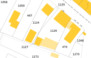
Carte du Plan Cadastral Informatisé
Carte du cadastre
Simple
Identification info
- Date (Publication)
- 2012-11-20T11:58:00
- Departement
-
- VENDEE
- Theme
-
- Restreint
- 02 - Partenaires Géo Vendée
- Theme
-
- Référentiels
- Plan Cadastral Informatisé
- Theme
-
- 02 - Vendée
- DGFIP
- Classification
- Unclassified
- Service Type
- invoke
- Description
- VENDEE
N
S
E
W
))
- Coupling Type
- Tight
Contains Operations
- Operation Name
- Accès à la carte
- Distributed Computing Platforms
- Web services
- Connect Point
- http://www.geovendee.fr/catalogue/consultation.php?id=5225 ( WWW:LINK-1.0-http--link )
Contains Operations
- Operation Name
- Accès au fichier contexte OWS de la carte
- Distributed Computing Platforms
- Web services
- Connect Point
- http://carto.geovendee.fr/services/GetContext/index.php?id=5225 ( WWW:LINK-1.0-http--link )
Contains Operations
- Operation Name
- Accès au fichier PDF de la carte
- Distributed Computing Platforms
- Web services
- Connect Point
- http://carto.geovendee.fr/services/GetPDF/index.php?id=5225 ( WWW:LINK-1.0-http--link )
- Reference system identifier
- EPSG / RGF93 / Lambert-93 (EPSG:2154) / 7.4
- OnLine resource
- Accès à la carte ( WWW:LINK-1.0-http--link )
- OnLine resource
- Accès au fichier contexte OWS de la carte ( WWW:LINK-1.0-http--link )
- OnLine resource
- Accès au fichier PDF de la carte ( WWW:LINK-1.0-http--link )
- Hierarchy level
- Service
- File identifier
- ffc888cd-e3a9-4404-9a9d-27c52627b408 XML
- Metadata language
- fre
- Character set
- UTF8
- Hierarchy level
- Service
- Hierarchy level name
- service
- Date stamp
- 2013-02-13T14:40:12
- Metadata standard name
- ISO 19115:2003/19139
- Metadata standard version
- 1.0
Overviews
thumbnail

large_thumbnail
Spatial extent
N
S
E
W
Provided by

Associated resources
Not available